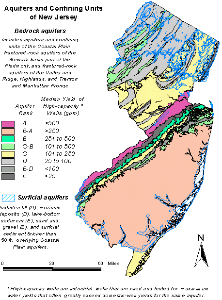
The Aquifers of New Jersey consists of two ARC/INFO Geographic Information Systems (GIS) coverages of the bedrock and surficial aquifers and confining units in New Jersey. The bedrock-aquifer coverage includes fractured-rock aquifers of the Valley and Ridge, Highlands, and Piedmont physiographic provinces, and aquifers and confining units of the Coastal Plain physiographic province. The surfical-aquifer coverage includes glacial sediment exceeding 50 ft. thickness in northern New Jersey, and surficial sediment thicker than 50 ft. overlying Coastal Plain aquifers and confining units. Both coverage's are generalized to the 1:250,000 scale by eliminating polygons with less than 1,000,000 sq. ft. area (about 23 acres). The data were digitized from various published and unpublished1:24,000, 1:100,000, and 1:250,000 scale geologic maps compiled from 1987 to 1993.